Tuesday, April 5, 2011

Liard Hot Springs - British Columbia

In British Columbia Canada is one of the earths made wonderful Hot Springs.  The Hot Springs are basically pools but it is natural made and can get up to 124 degrees Fahrenheit.  It does not have one single heater and it gets its heat from the earth’s magma heating the water that comes into the spring.  (It felt amazing!)  In fact one part of the hot spring is boiling water (See Picture).  Since one part of the spring is boiling then it has to have some way of cooling it down.  It has another spring that comes in to the spring from a waterfall out of the mountain.  They create the temperature you feel!  If you go to the side with the falls and the boiling water when you enter and come out you have to stir the water or you will burn.  There is a spot for kids that is warm so that he they don’t get too hot!
Erin
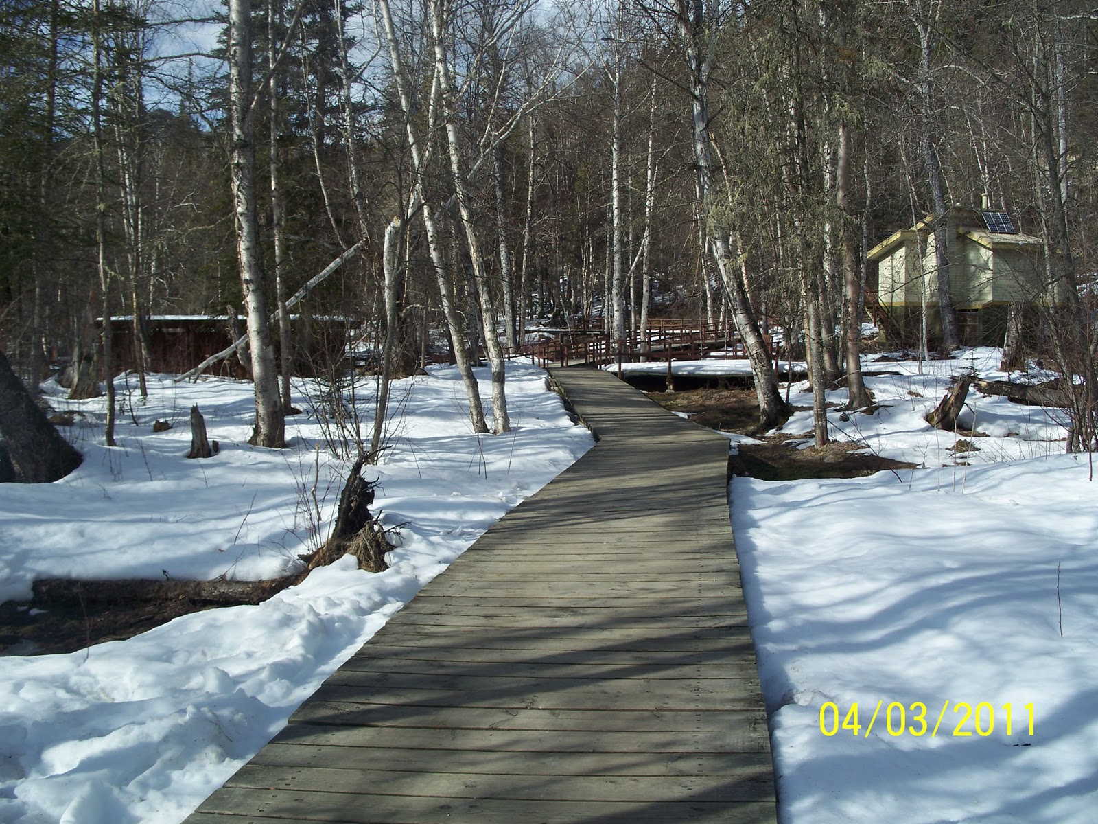
Pathway leading to the hot springs

Liard Hot Springs

Cold Water Rolling out of the moutain

Notice the water bubbles from the water boiling

Hot Springs Deck and Pool

Pathway leading up to the hot springs

Alaska Highway History - Andrew

Hello!!  We are on the Alcan Highway in Canada, and that’s what I have to talk about today.
                The Alcan (Alaska Canadian Highway) took 8 months to complete, and over 10,000 men helped make it.  The highway stretches for about 1,400 miles.  The road was built by the American Army to help connect Alaska to Canada and to the lower 48.  Roosevelt commissioned the road to be done February 11, 1942.  With the bombing of Pearl Harbor this road became a military need.  The United States agreed to pay for the road and turn it over to the Canadians after the war.  The Canadians agreed to supply the materials and give the right of way.  This road was necessary to help with transportation of supplies. 
To build the road they would have 3 men who would go out together.  The first man would stick a pole in ground and then the next person would walk as far as they could go and still see the first person and he would stick a stake in the ground.  Then the first person would go past the third person to stick another stake in the ground and they would continue to do this over and over again.  These were the stakes that would line the pathway for the road to be made.  These men would travel 10 to 15 miles on a good day.  For meals they would have for breakfast 3 pancakes and coffee, for lunch (if there was lunch) they would get 2 biscuits the size of quarters and they were as hard of rocks.  Dinner was fish and potatoes, and no cigarettes! 
The road was opened to the public in 1948, and was named an International Historical Engineering Landmark in 1996.
                So how is soccer going?  I have seen allot of cool stuff but I really miss soccer and you guys.  Can’t wait to come back.

                                                                                Andrew.

The Alaska Highway - We're Here!!

We made it to Dawson Creek!!  This is the start of The Alaska Highway.  Andrew has written a bit about the history of the highway which is pretty interesting.   Please see the pictures that I will post to that will show mile marker 0 of the highway.
It is so rewarding to finally see the towns that we have only viewed as a dot on a map in our planning books.  The towns are much more rugged and far between than I thought they would be.  I am still so impressed with the beauty of this country.  I am sure the pictures will not do just to what our eyes have seen.  I find it imposible to find words that even fit the scenery.
The drive from Dawson Creek to Liard Hot Springs did not prove to give us much in the way of seeing wildlife, but the views more than made up for that.  There was one mountain that we came across that I will never forget.  As we crested the mountainside there was a sign post telling us to put on chains if you didn’t have snow tires and that the grade following would be 10%. (Which is quite steep for a road).   After we crossed over top I think my mouth literally fell open.  I don’t think I have seen mountains and valleys so expansive in my life.  The mountains were covered with snow and had trees that were gently peeking through in places.  The mountains descended rapidly into a huge valley that had a river cutting through it.  The river was mostly covered with snow and Ice.  The water that was visible was a beautiful blue/green color.  Wow!!!
We reached Liard Hot Springs which was extremely relaxing and we all needed a break when we got there.  The water was so hot, but the snow around it was so cool!!
After the swim in the hot springs, we headed out  for a town called Pink Mountain.  Briefly, after leaving we saw three horned mountain rams and three heards of bison (about 100 altogether) and Caribou.  We had hit the wildlife jackpot.  We almost hit the rams as we turned one of the curves.  We were detained about 3 minutes while one of the heards of bison crossed in front of us.  They were taking their own sweet time!!   When we arrived in Pink Mountain we got out and played in about 3 feet of snow.  It was fun.  There were snowballs to be thrown and snow angels to be made.
We continued on through the Yukon enjoying the views.  I was surprised to see how much of the road was basically dirt as we got close to the US Border.  The 50 miles prior to the border was slow moving, about 5 to 10 miles per hour in many, many, places.  So you can imagine how wonderful it was to see the Welcome to Alaska Sign.  There were shouts of Joy as we crossed back into the most wonderful country The United States of America!!!
Hope to post more soon.  Thanks for reading. 

Saturday, April 2, 2011

Pics From Edmonton to Pink Mountain British Columbia

Campground in Edmondton

Outside (before) Dawson Creek

Before Dawson Creek


Mile Post 0 of the Alcan


British Columbia

British Columbia

Snow at Pink Mountain BC

Erin in Snow Pink Mountain

News of the days

It has been a couple of days since I have written.  We have seen some beautiful country!! 
After leaving Hot Springs, South Dakota we crossed into Wyoming.  We were trying to make it to Sheridan Wyoming to sleep for the night.  We were coming across the Big Horn Mountain range.  When we were about 30 miles from Sheridan the wind began to blow very fiercely.  The RV was rocking back and forth.  Dad was forced to hold the steering wheel at a 45 degree angle into the wind just to keep us on the road.  There was probably twice that we were bracing in preparation of the RV flipping over.  We found out the next day that the winds were blowing at 25 miles per hour and gusting between 50 and 55 miles per hour.  Being at the top of the mountain range we were taking the brunt of the wind storm.  I was so thankful to be in Sheridan where we were able to park the RV into the wind and avoid rocking.  After getting there, Dad and I went outside and I can honestly say I have NEVER heard the wind Howl like it was that night, nor have I been in a wind so forceful.  It will forever be a sound and feeling stuck in my memory.
The next morning (Thursday, I think) we got up and headed for Shelby Montana.  Once again we were greeted by 25 mile an hour winds, but luckily there were not the gusts so we did well.  The drive was amazingly beautiful.  The land is so flat and the sky is huge, hence the name for Montana “big sky country”.  We could see snow capped mountains in the distance but seemed we could never get close to them.  We drove for hours and never reached them. 
Along the way we saw the huge white windmills.  It seems that you could say they are windmill farms.  They were perfectly situated in the high wind areas grabbing as much of the wind as they could.  In one of the towns they had one of the blades on display and we stopped to look at it.  The individual blade is about 20 feet long.  There are 3 blades per windmill.  I would say that they stand about 100 feet tall.
We then proceeded on toward Shelby.  We got to Shelby and hunkered down for the night.  When we awoke the next morning the field in front of us was filled with Mule Deer and rabbits.  It was God’s way of saying good morning!!  After seeing that, the kids and I played some soccer and then headed for the Canadian Border.
At the border check in we were delayed about an hour because I did not have a notarized note from John saying that I could cross the border with the children.  They questioned us and finally let us go.  Then, because dad is carrying a gun with us we had to stop and get that registered prior to them letting us pass through.
After crossing the border (which is our half way point), we began to see snow all over the ground.  The kids were excited about that.  We managed to stop at a couple of places to play.  We stopped over in Edmonton last night where there was about 3 to 4 feet of snow on the ground.  I have included some pictures of the camp site.  The snow was huge!!! We were told that the road ahead was good and that there was no snow expected until tonight (Saturday.) So we should make it to Dawson Creek tonight which is the start of the Alaska Highway (Alcan Highway).  At that point we will be 1,488 miles from Fairbanks, Alaska.  It is so good to see all the towns that we have been plotting on a map for months!! 
Thanks for all your support !!  I enjoy sharing with you all!!

Friday, April 1, 2011

More pics from the road

Mountain Goats in South Dakota

Poppy and Andrew

Kids in Wyoming

I can actually drive this thing!!!

South Dakota

Mt. Rushmore

Erin - Mount Rushmore and the Drive

    On Wednesday we went to Mt. Rushmore and we saw the famous mountain.   There are four men carved into the mountain.  One of them is George Washington, one is Thomas Jefferson, one is Abraham Lincoln, and one is Theodore Roosevelt.    They were each chosen to be carved onto the mountain for a certain reason.  George Washington was elected for the American spirit of independence.  Abraham Lincoln was elected for keeping the country together after the civil war.  Thomas Jefferson was selected because of his involvement with the Declaration of Independence.   Theodore Roosevelt was chosen for his community projects such as the National Park System.  I had a lot of fun looking at it and taking pictures!
Then we drove through Montana and Wyoming we experienced twenty-five mile an hour winds.  Whenever we were driving straight the steering wheel was turned sideways into the wind to keep us on the road. (Our RV was rocking from side to side and my MOM almost had a heart attack but luckily I was asleep.)  We also saw more of the big huge wind mills.  Oh yeah and we have seen so many cows if I see another one I think I might die.
  When I woke up this morning I saw some mule deer and I went outside to see them.  Then before we left we kicked a soccer ball around for a while at the camp grounds.  After we drove from Shelby Montana to Edmonton BC Canada.  Now we are in a RV rest area with a ttttttttoooooooooonnnnnnnnn of snow.  Mom says about 3 feet!!!
                Erin